Leaving Golden, CO is never easy, but we pulled out June 13th and headed farther west.
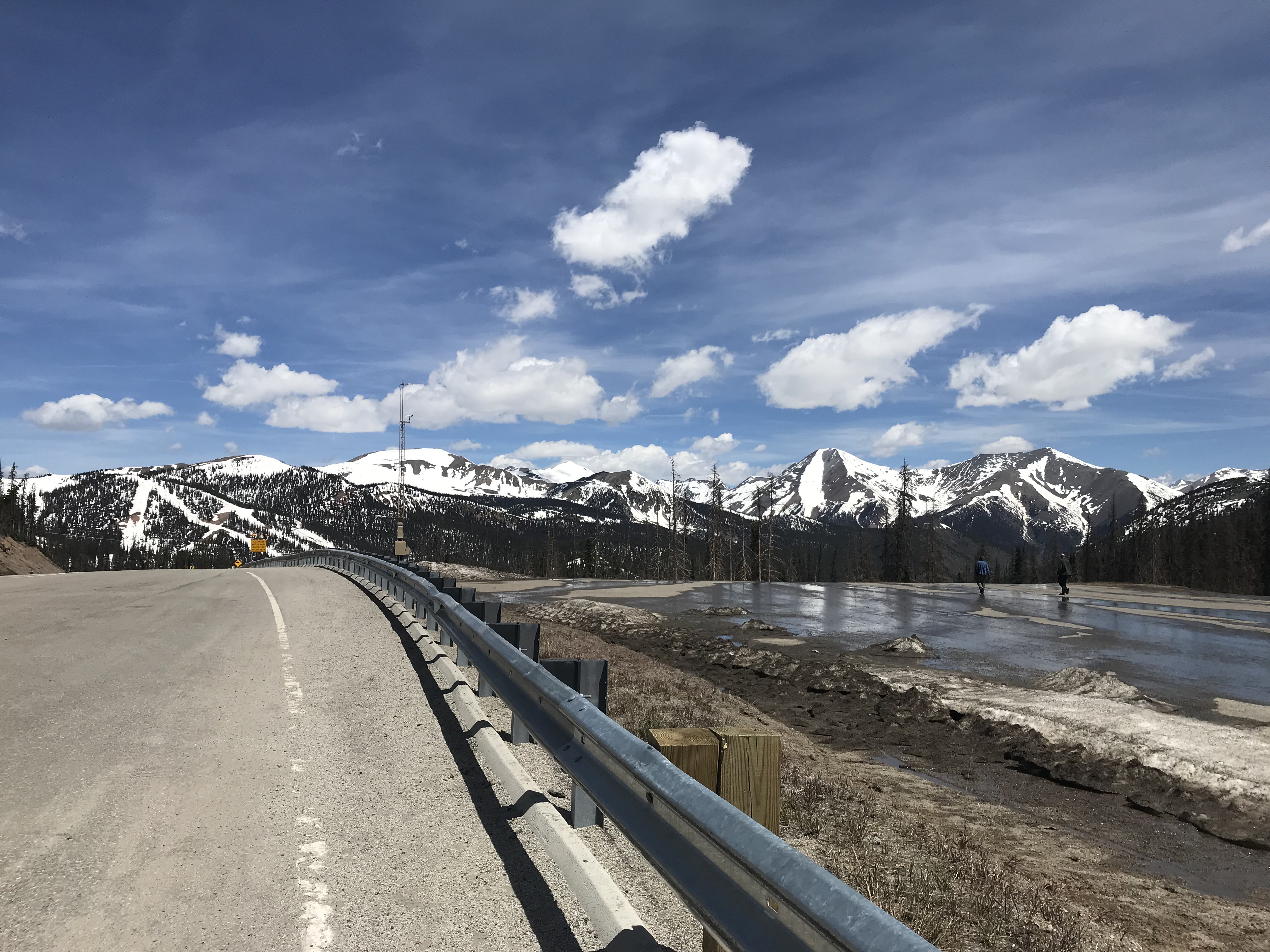
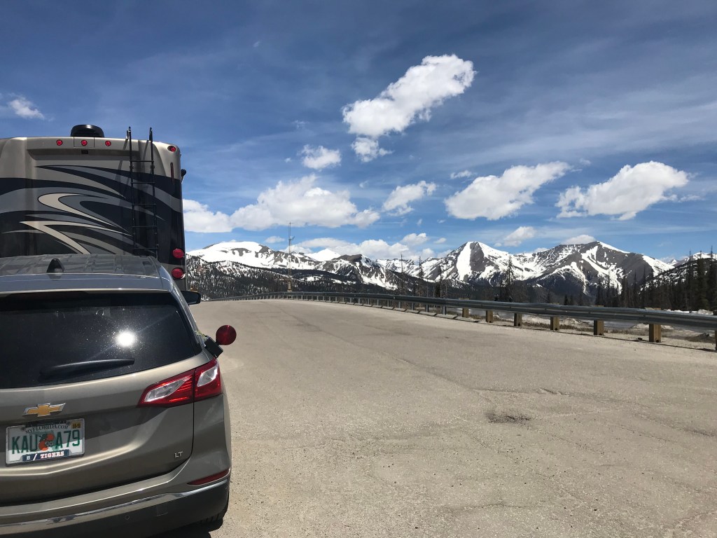
Our destination of Ridgway, CO was about a 280 miles drive that would take us over the Continental Divide at Monarch Pass just west of Salida, CO on Hwy. 50. After making sure Hwy. 50 was a “RV friendly” road, we drove a very scenic route through the mountains. It took us most of the day with stops and slow going on the uphills and winding curves.
Jim did the driving and I was happy to be the passenger during this drive. He had been keeping an eye on the trailer tires and was scheduled to replace them when we returned to Michigan.
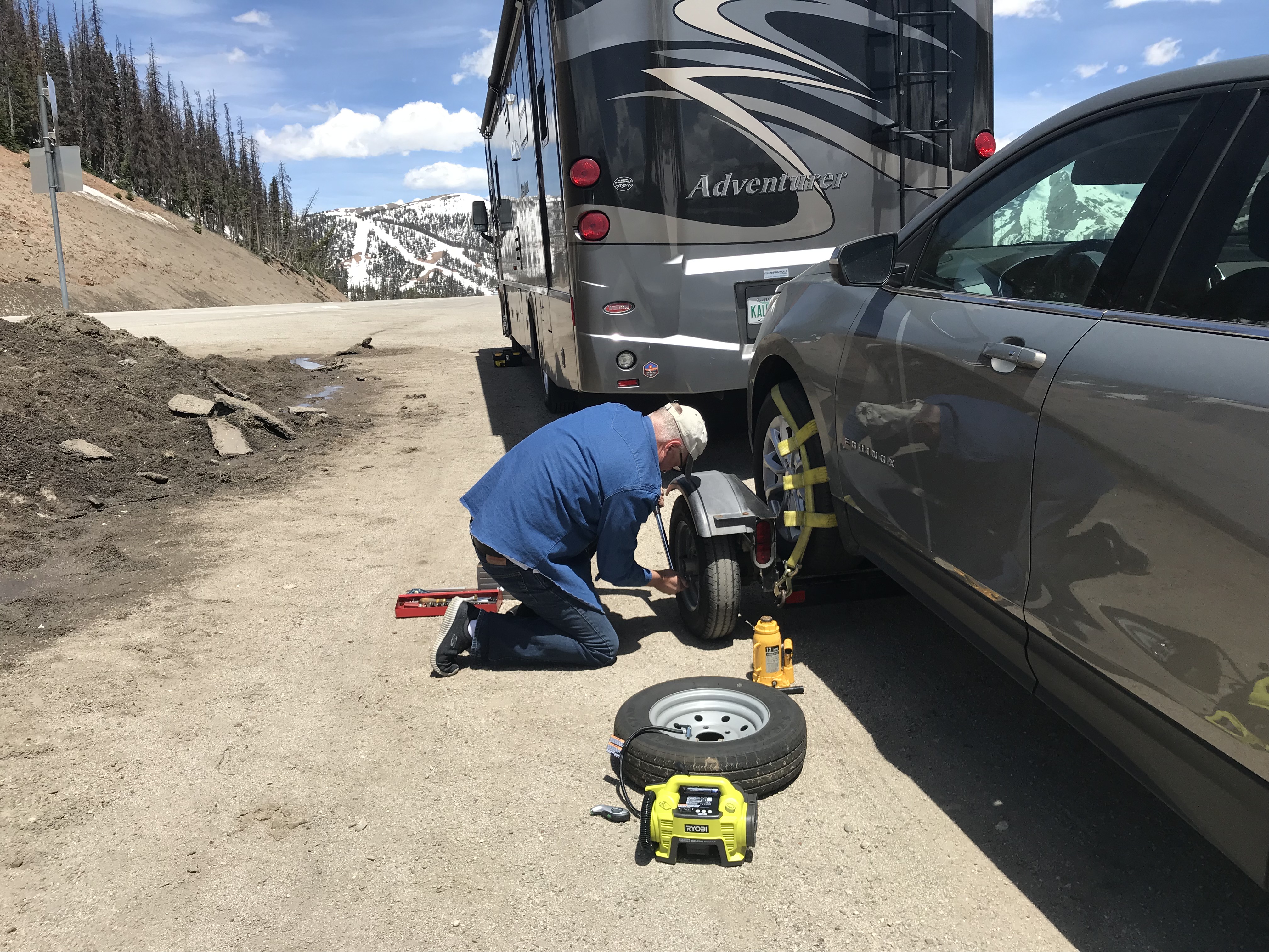
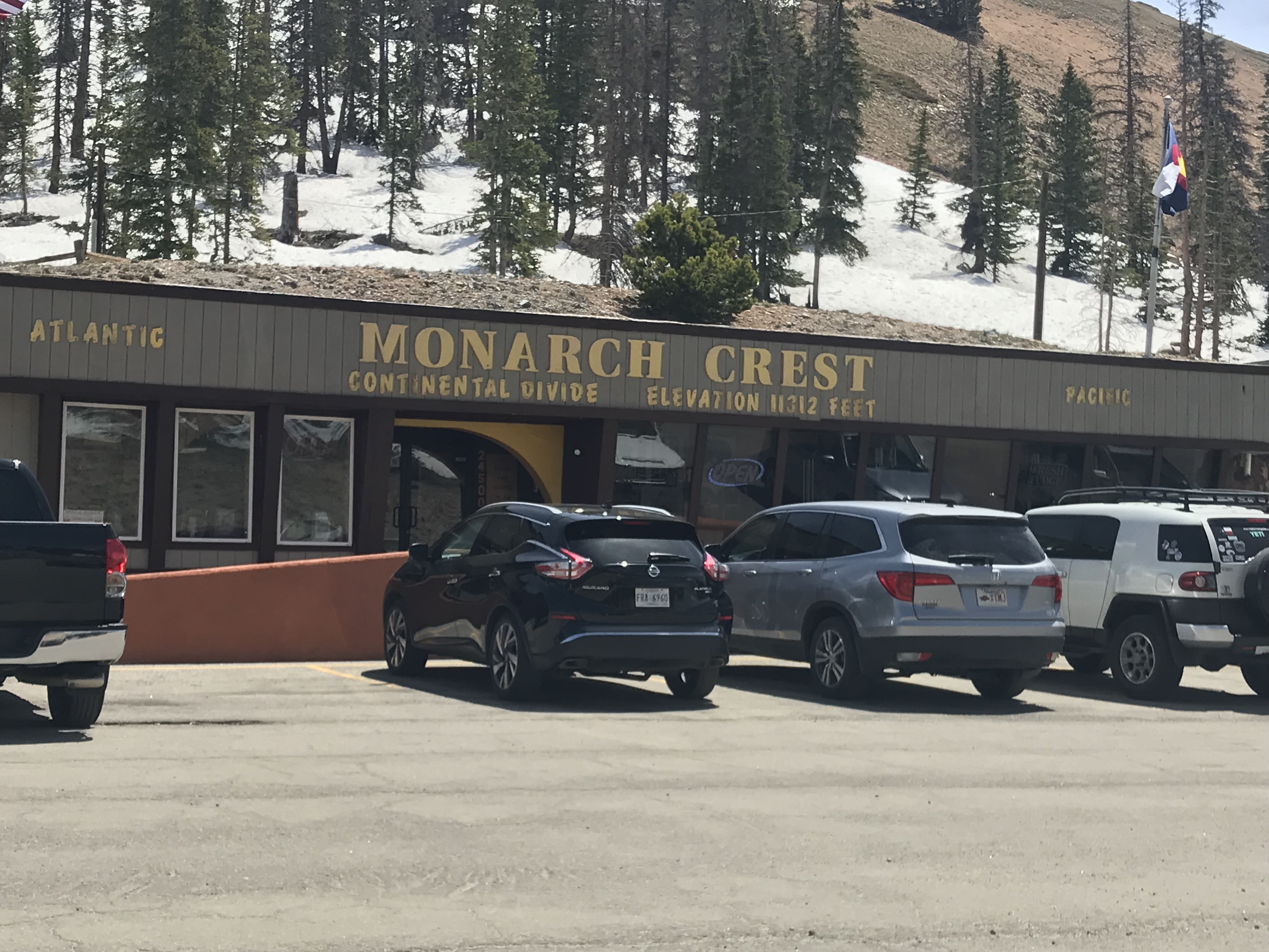
When we stopped at Monarch Pass, Jim decided one of the tires had gotten significantly worse, so he changed the tire right there at 11,312 feet elevation. It was no big deal for him, as he had everything he needed and had it taken care of rather quickly. No sense in taking any chances, especially on these narrow mountain roads. It’s such peace of mind to know he is watching these things and can take care of them when needed.
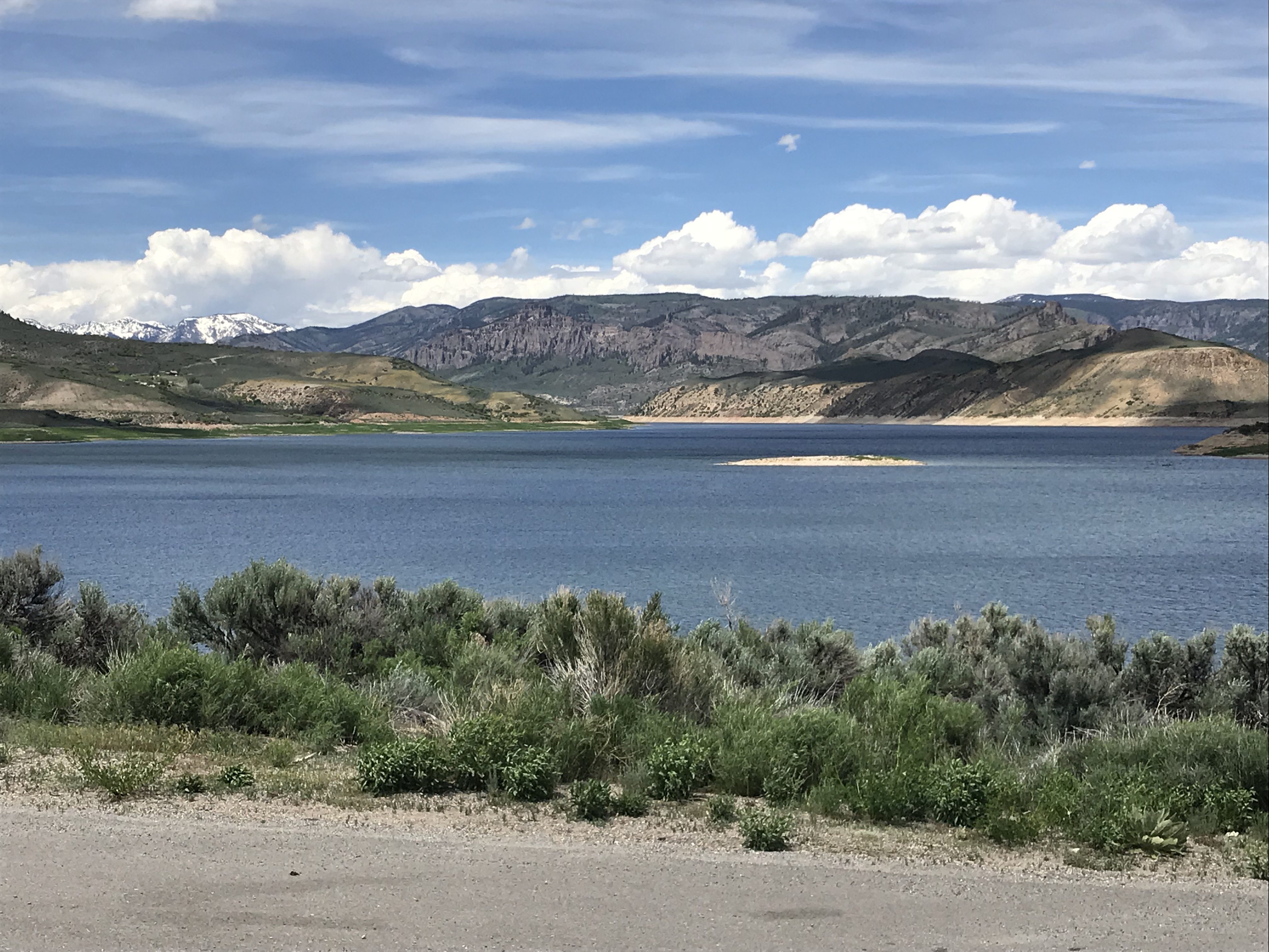
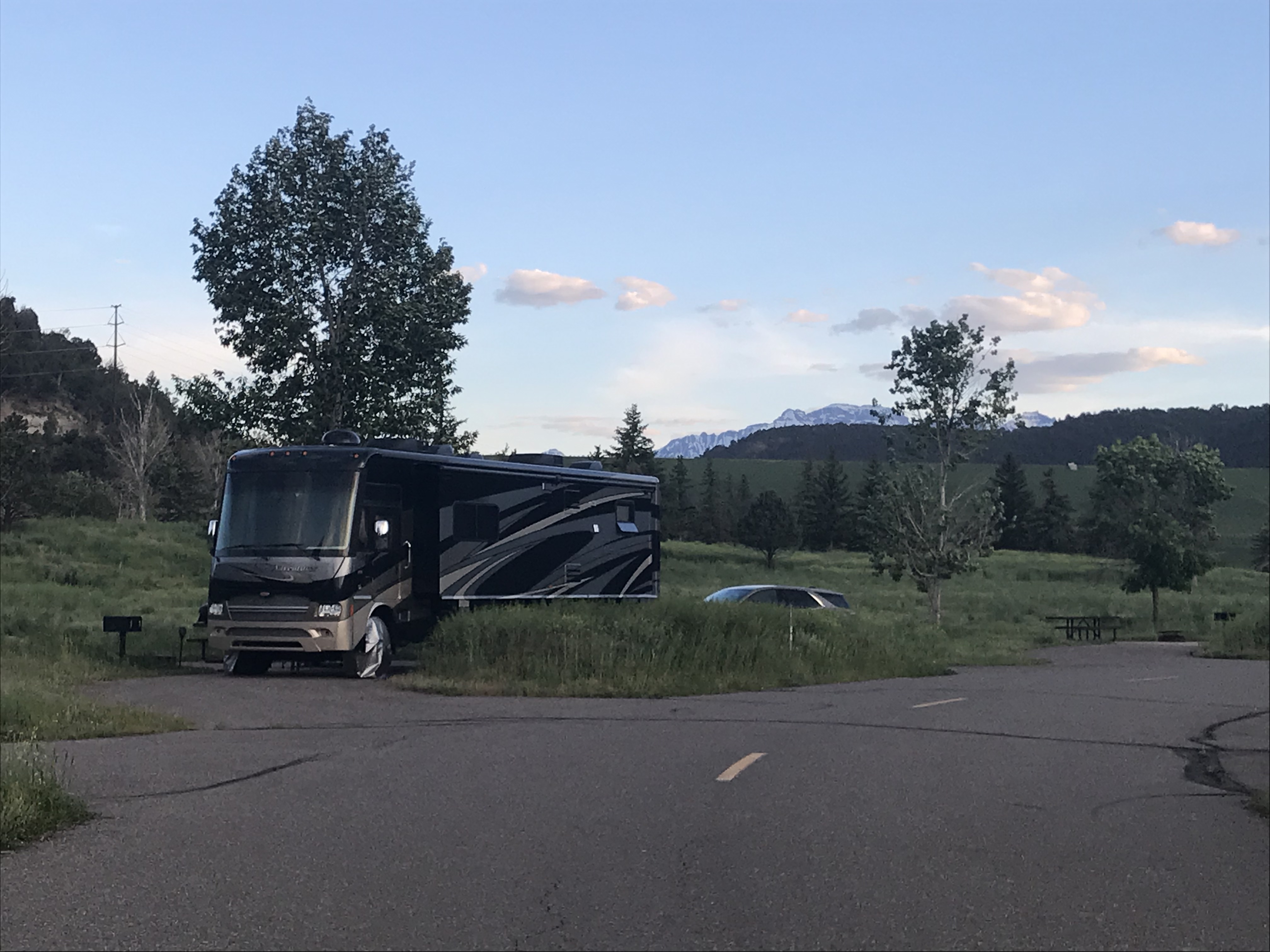
We settled in to our campsite at Ridgway State Park. A large park just off of Hwy 550 south of Montrose, CO at the base of the San Juan Mountains. The Ridgway Reservoir is the heart of the park formed by an earth dam of the Uncompahgre River.
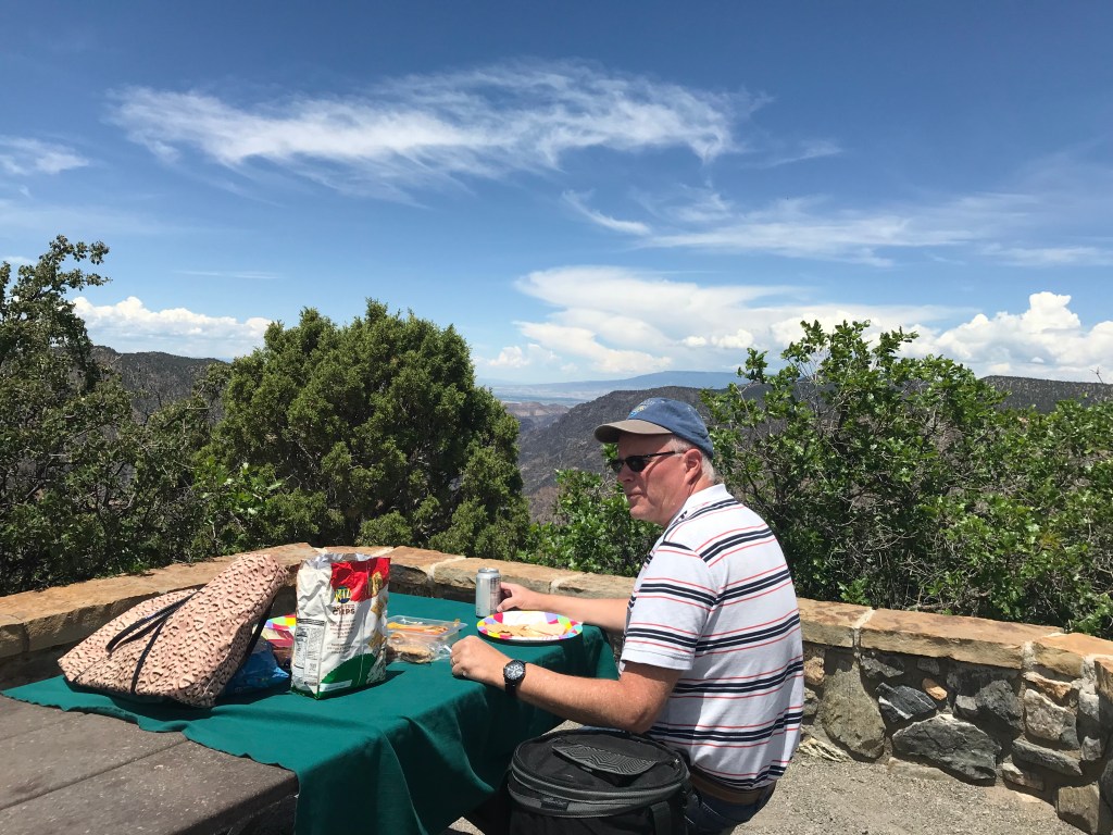
We stayed in the Pa-co-chu-pak Campground, one of three campgrounds in the park. Located near the dam and river, we had full hook-ups and some hiking trails close by. This location served as our base while we make day trips from here.
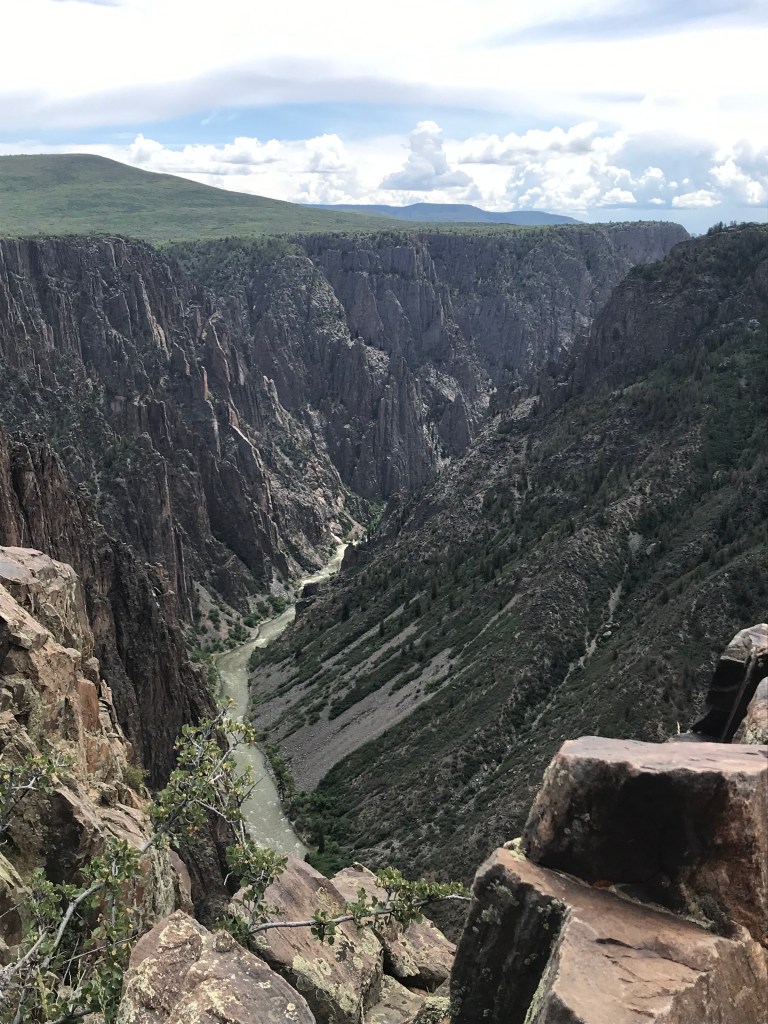
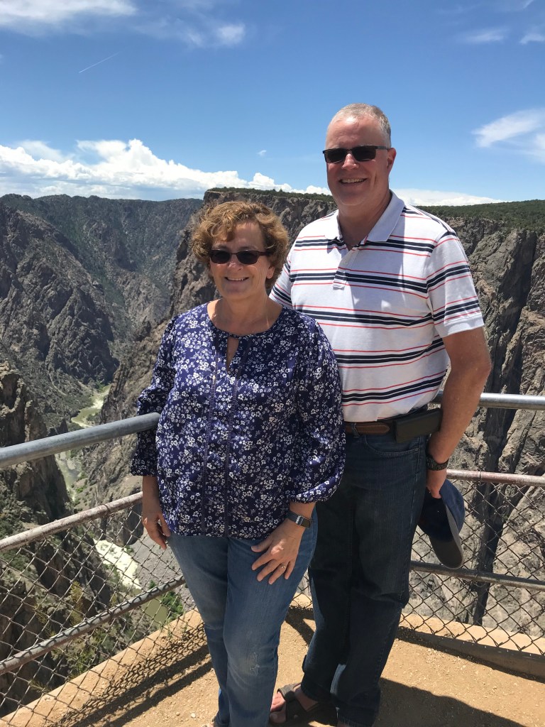
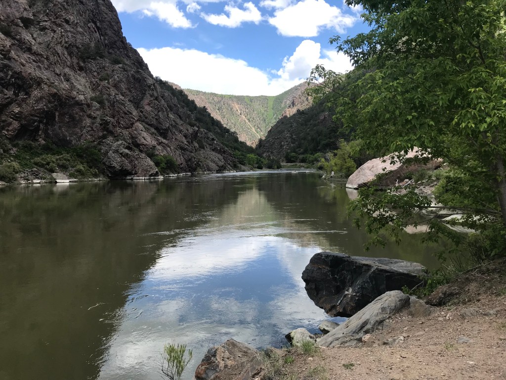
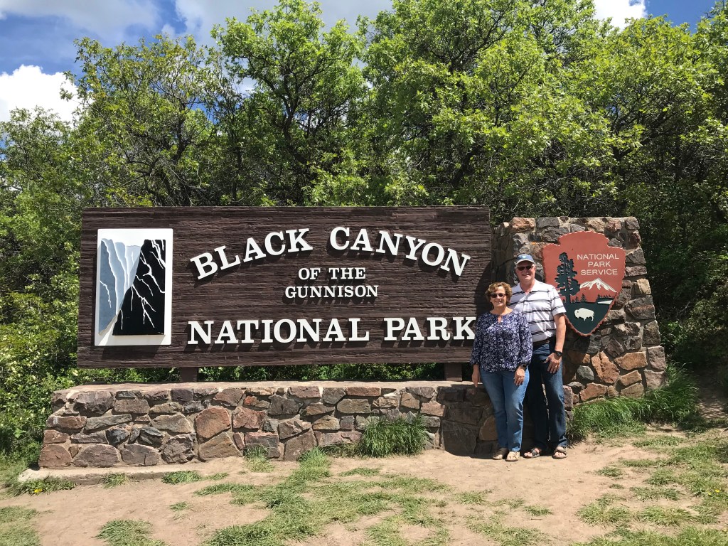
After a day trip to the ski town of Telluride, we visited Black Canyon of the Gunnison National Park. This park is not as well known as others, and is one of the newest national parks designated as such in 1999. The south rim entrance is west of Montrose, off Hwy. 50 and was an easy drive from the campground.
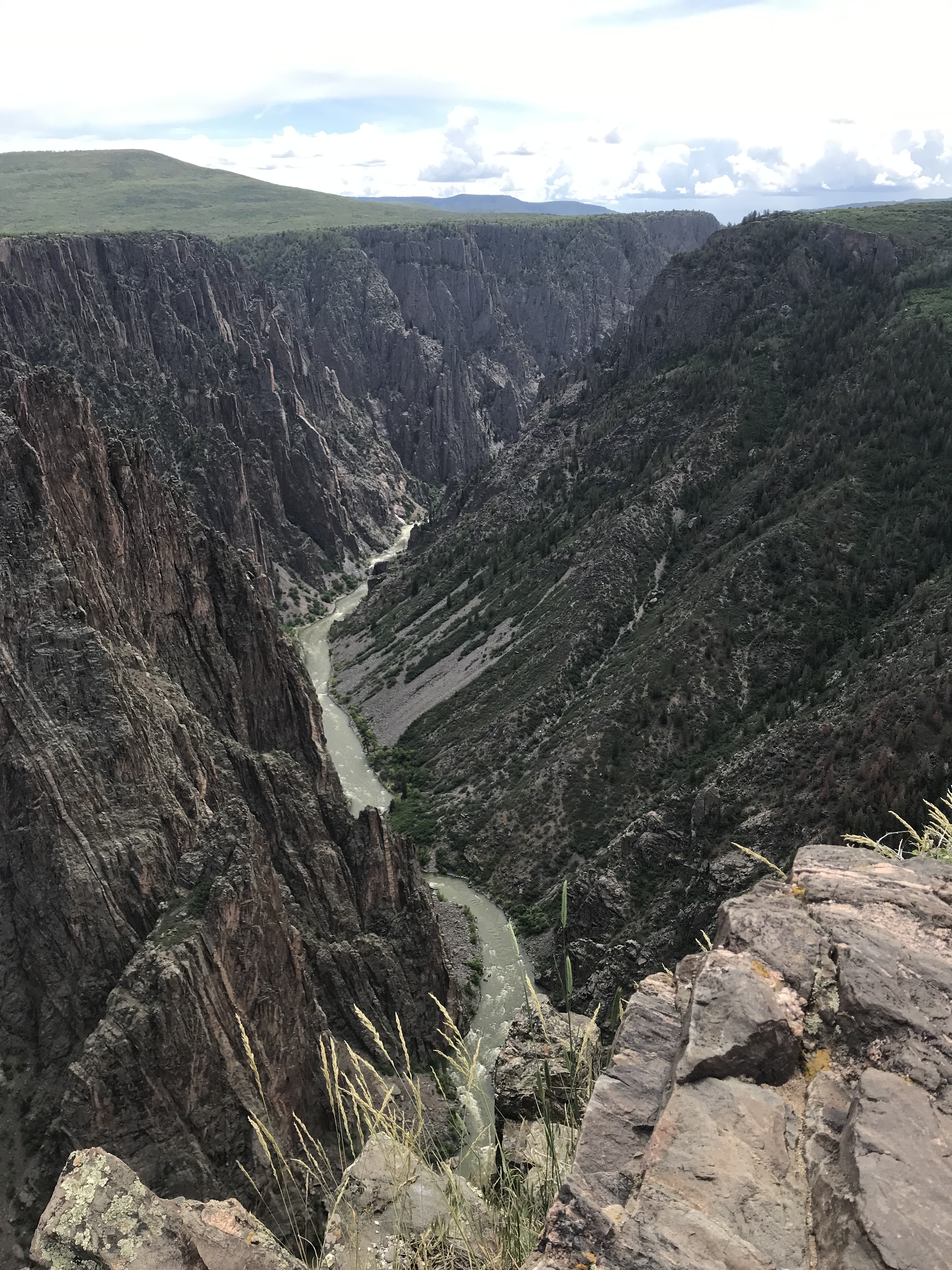
The Park encompasses twelve miles of the deepest and most dramatic section of the Black Canyon carved by the Gunnison River far below. Some sections of the gorge are so narrow and deep it receives less than an hour of sunlight a day; making “Black Canyon” an appropriate name.
Many great overlooks throughout the park give different views of the canyon. Some are an easy walk from the parking area, while others require a .25 – .50 mile walk. There are also longer hiking trails available in the park. The East Portal Road near the entrance is a steep descent to the bottom of the canyon on the east end of the park.
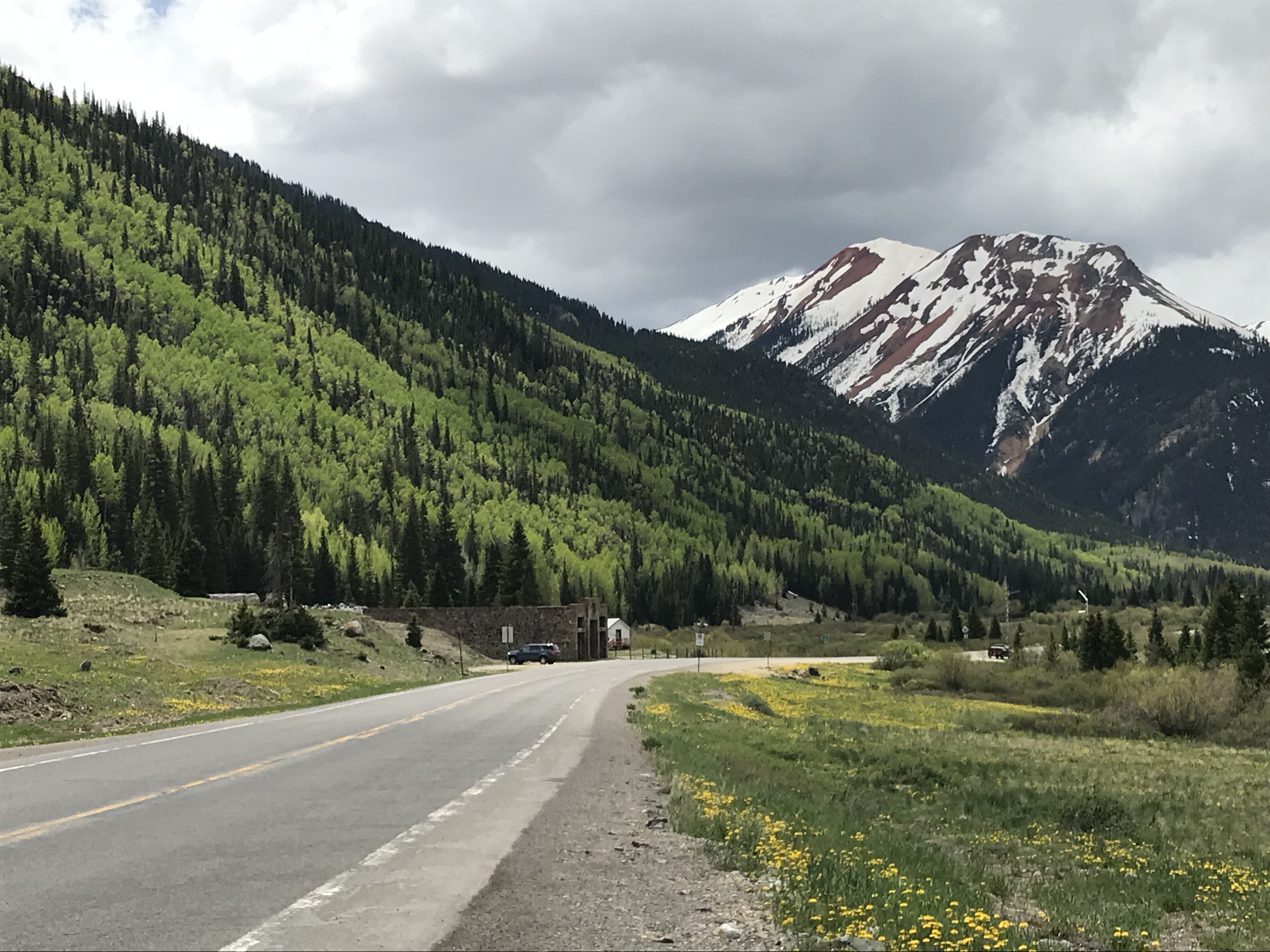
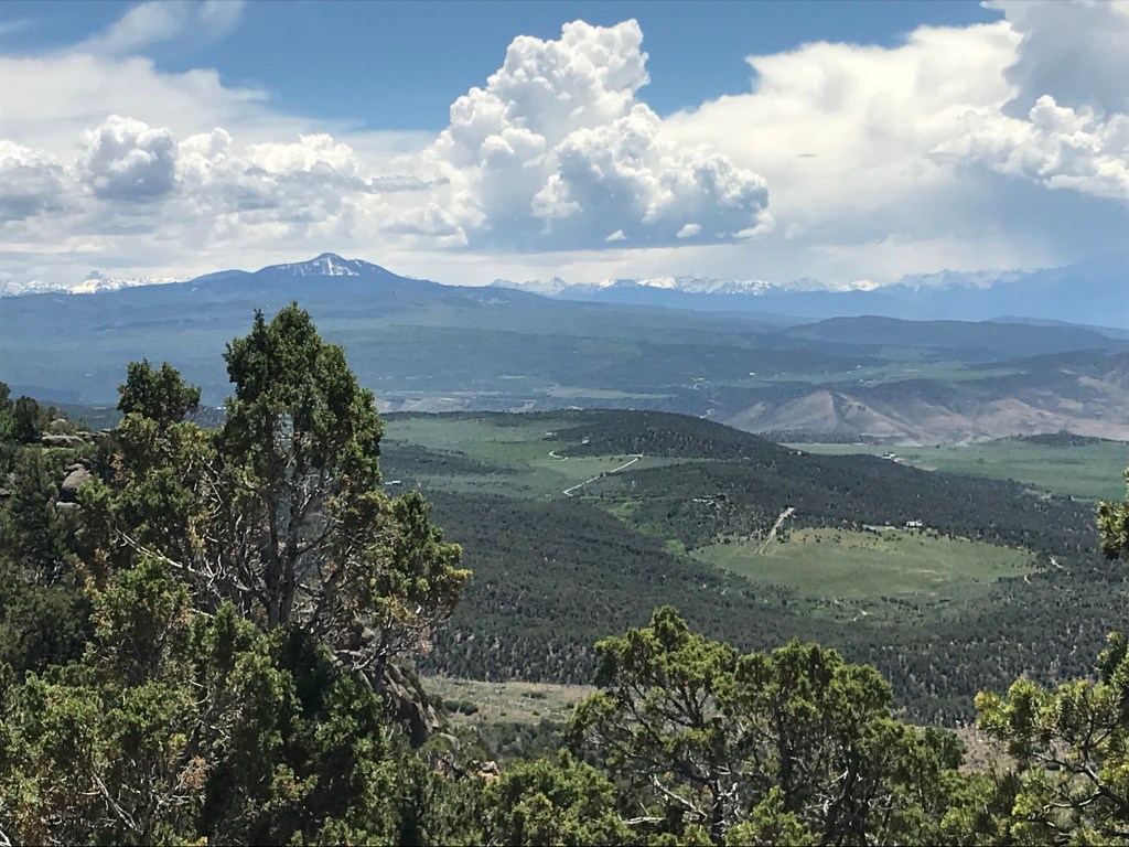
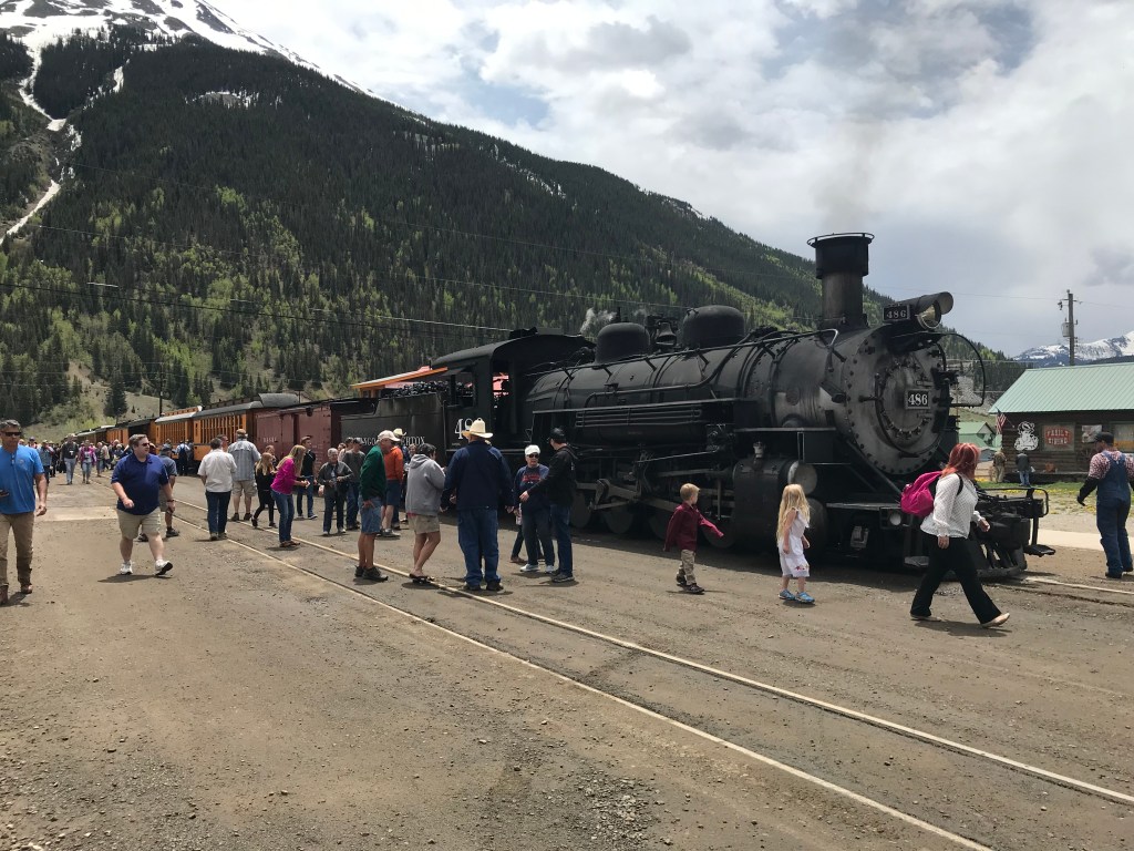
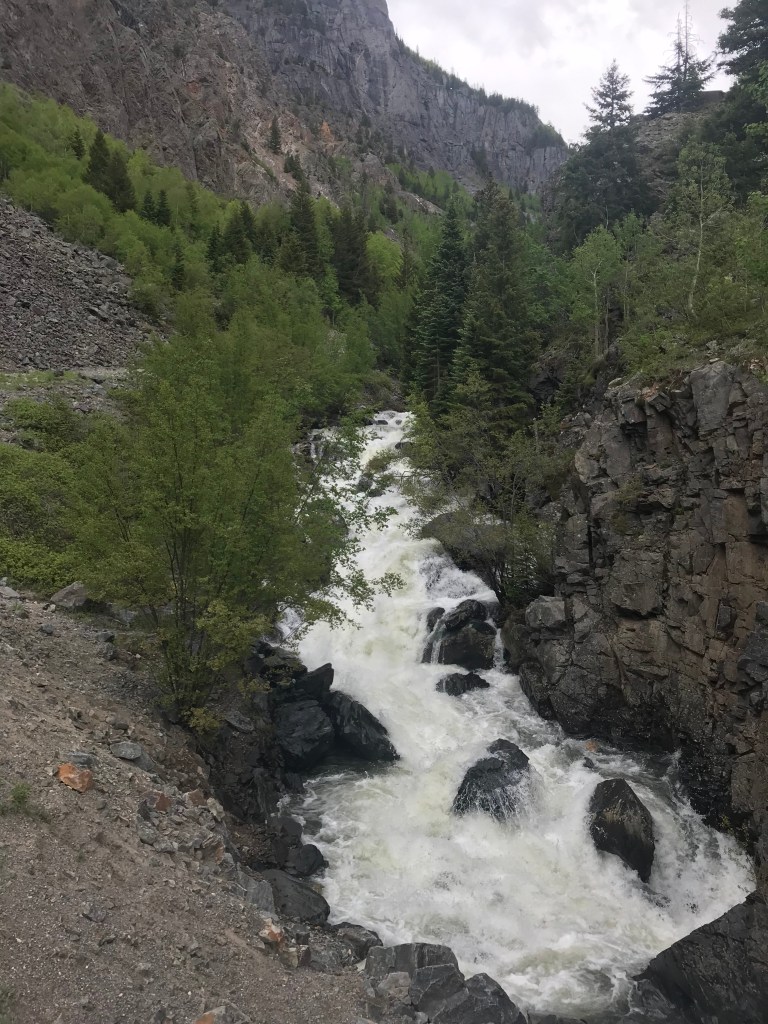
The “Million Dollar Highway” can be found south of Ridgway through a section of the San Juan Mountains between the towns of Ouray and Silverton, Colorado.
We enjoyed the drive through several mountain passes with scenic views and lots of snow at the higher elevations.
Several waterfalls were running full from the melting above average snowfall this past winter. (Click on the video)
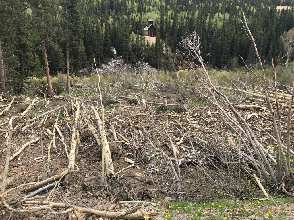
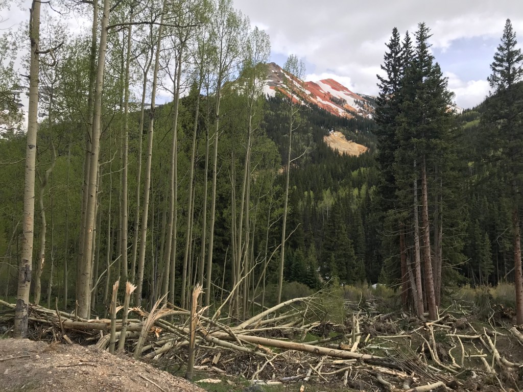
We also saw the results of numerous avalanches during the winter. Areas of flattened trees and debris. The power of the snow must be tremendous.
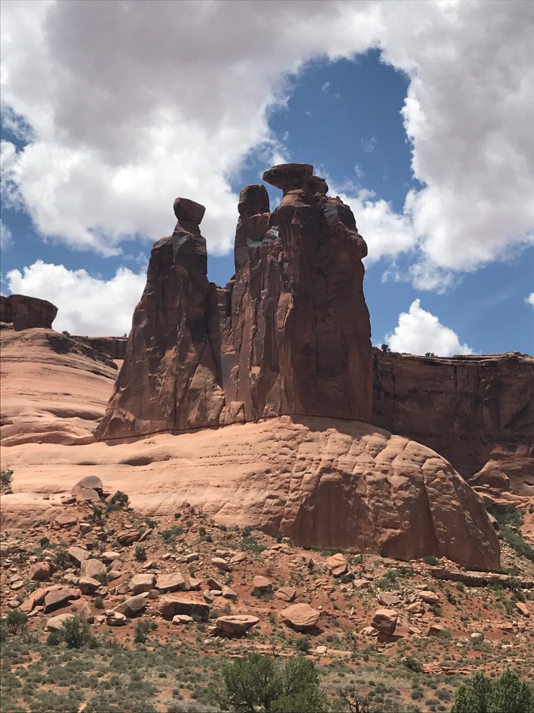
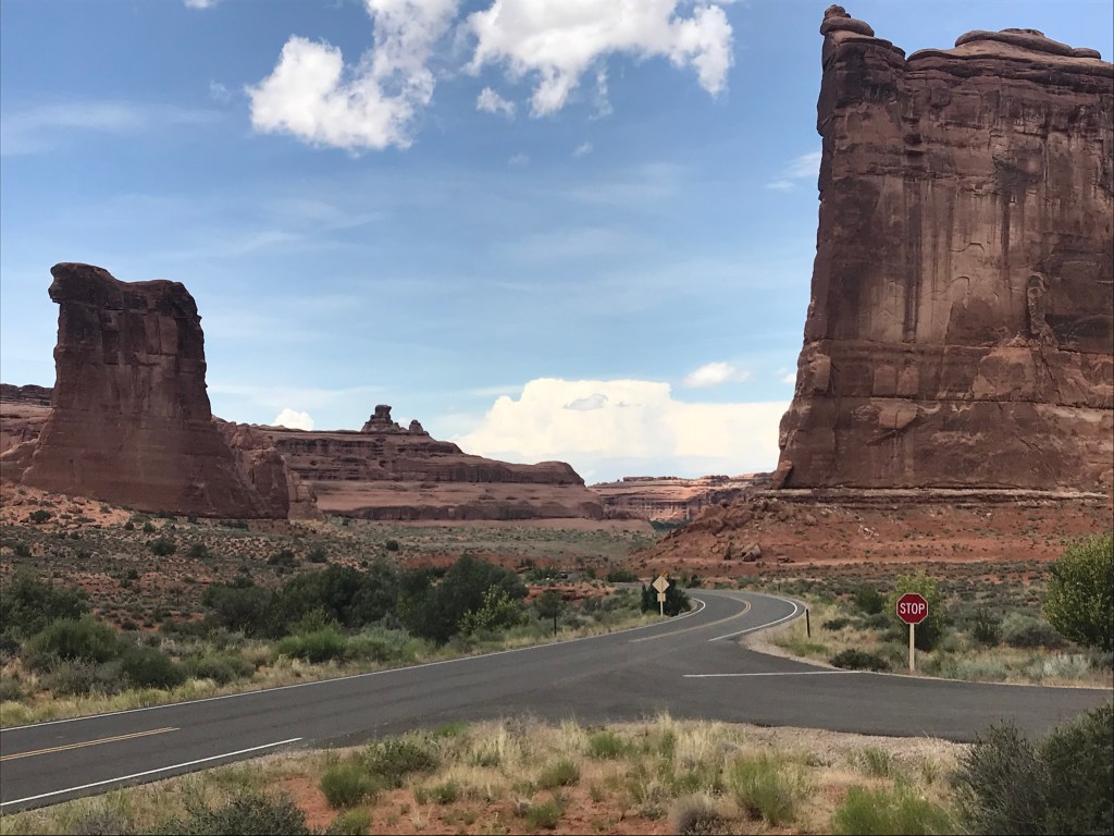
Arches National Park was about a three hour drive from our location, so we decided to make a two-day trip out of it, leaving the RV at Ridgway, and getting a hotel room for the night.
We visited Arches several years ago, but discovered a couple things we missed the first time (or forgot).
Like most national parks, there is lots to see and hiking trails of various lengths. With its’ location in the “high desert” it is very warm this time of the year and throughout the summer and fall, with very little shade, so be prepared. The park has reminders everywhere to take water with you on even short hikes.
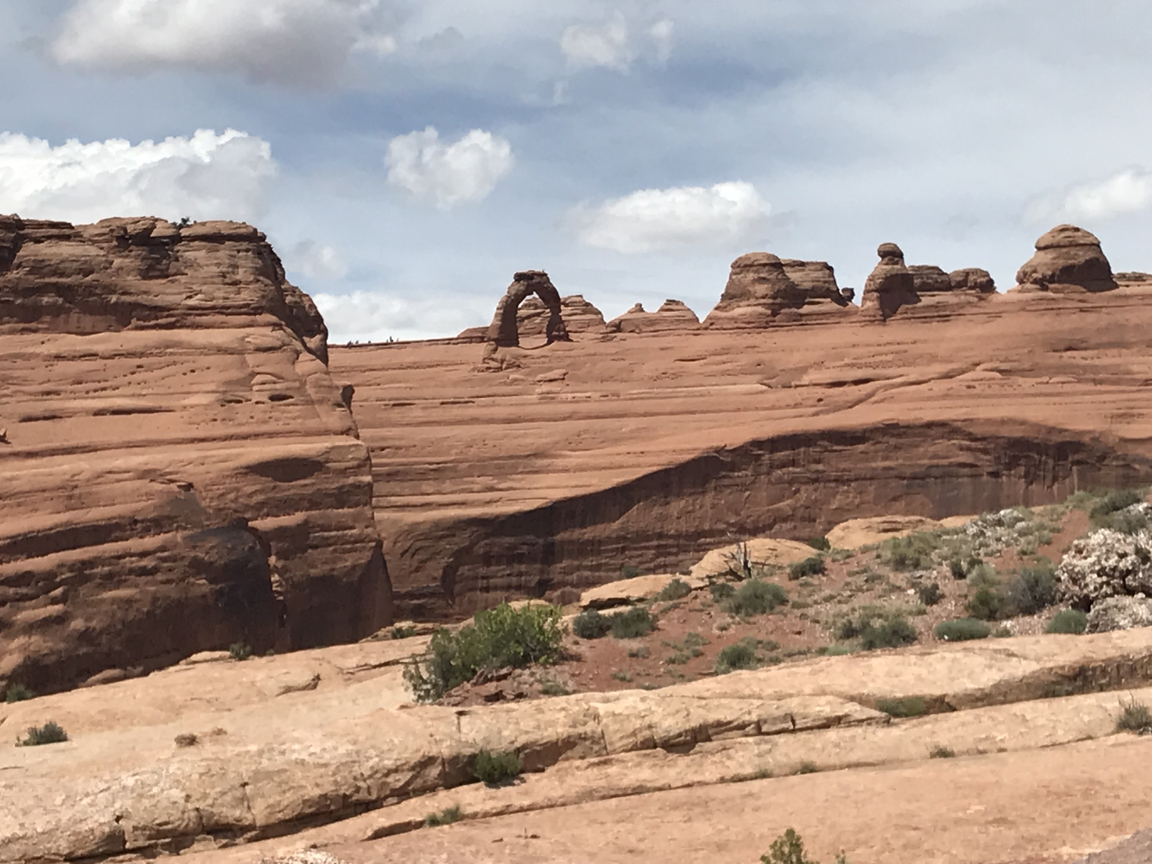
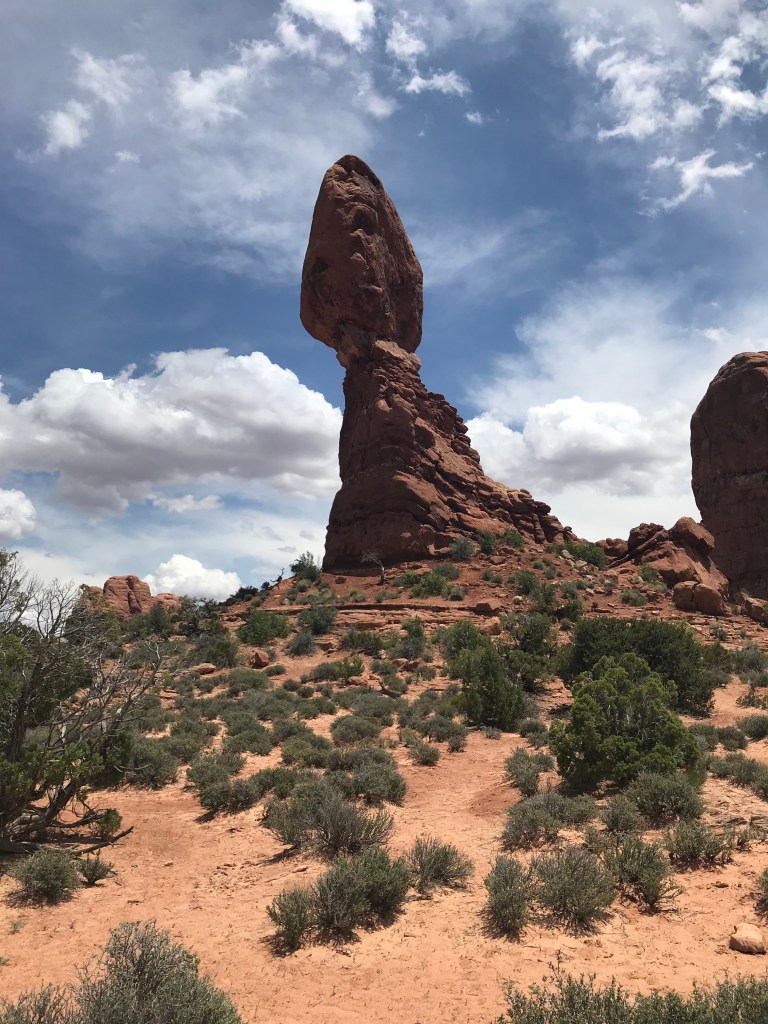
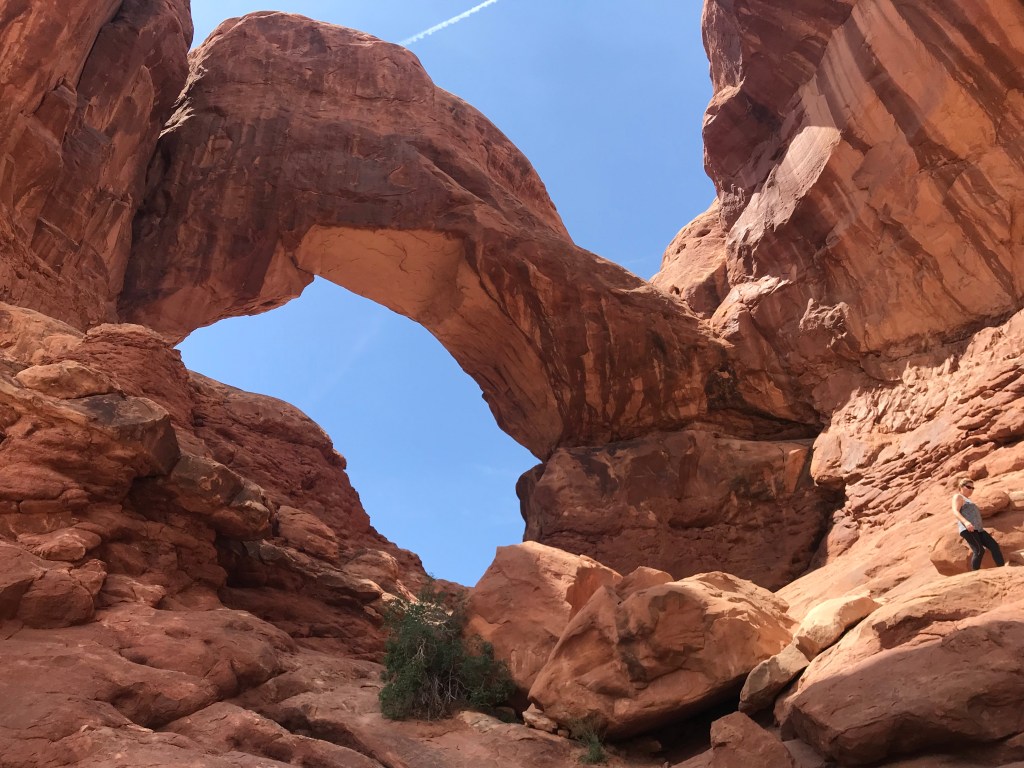
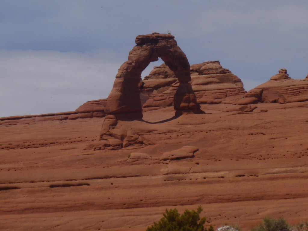
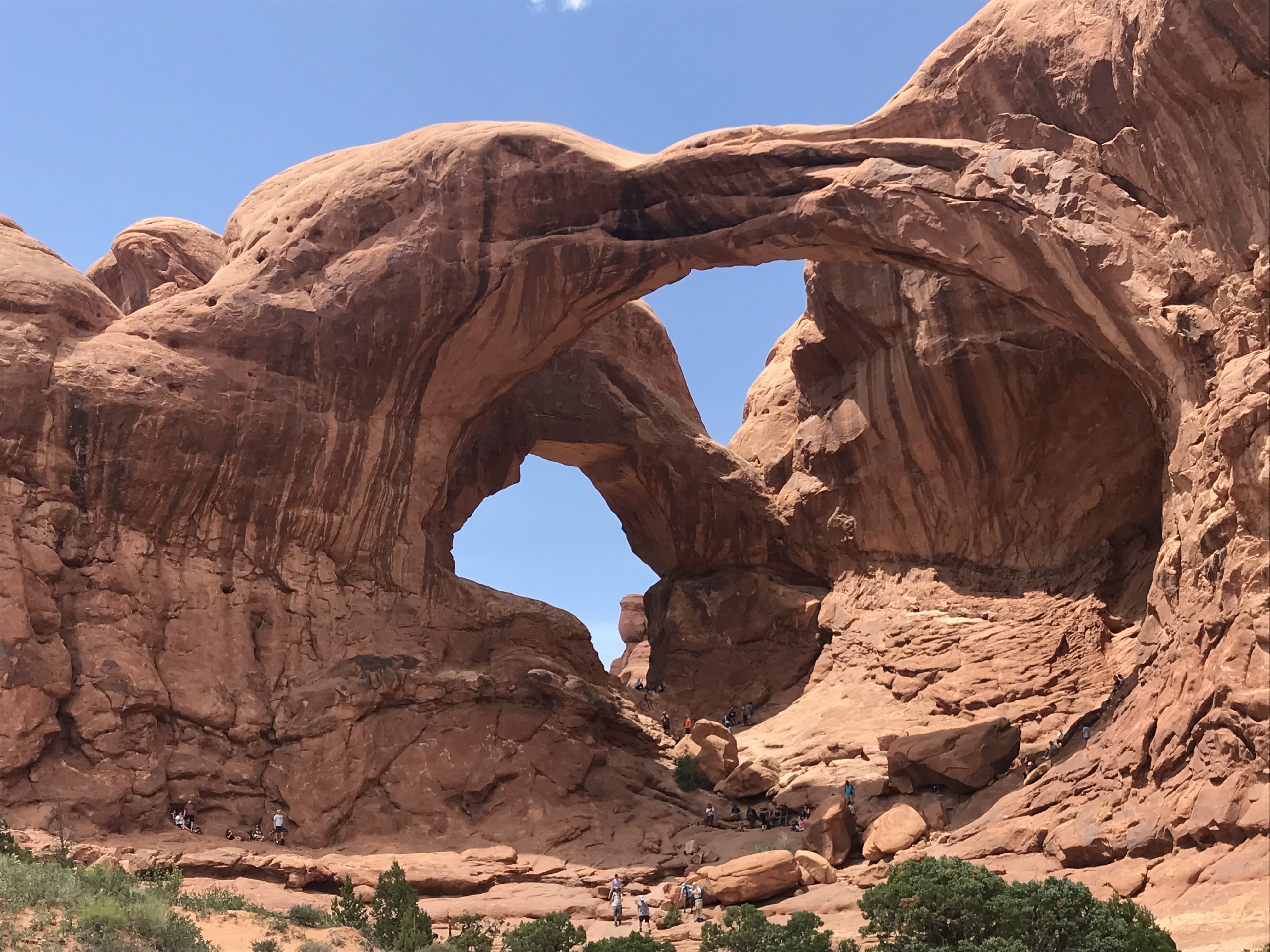
A very popular park, it was already busy with summer visitors and parking at some locations was a challenge. The “Delicate Arch” is the one you see in most of the promotional pictures of the park, but is not the easiest one to see in person. There is a three mile “advanced” hiking trail that takes you up close to this arch, but we opted for the .50 mile moderate hike that gave us a pretty good view from a distance. The “Double Arch” is an easy one to see up close with a short walk from a parking lot.
After another day back at Ridgway S.P., we left to make our way back to the Denver/Golden area. We headed north and took Hwy 50 to I-70 and spent one night at a park in Glenwood Springs. Located right on the Colorado River, the park was taking precautions with the high water level by sandbagging along river bank. Luckily the RV sites were up higher from the river.
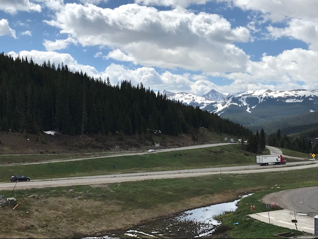
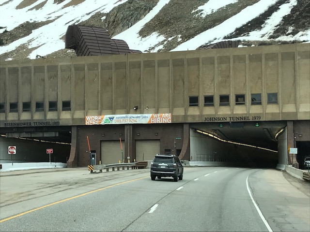
Continuing east, we came through Vail Pass and the Eisenhower/Johnson tunnel near Loveland Pass at the Continental Divide. Not an RV drive we would like to make often due to the steep up hills, but enjoyed the scenic vistas along the way.
Back near Golden, we got ready for a visit from granddaughters Anna and Megan, coming to stay for a week or so. It will be fun showing them our love of Colorado!
“Everybody needs beauty as well as bread, places to play in and pray in, where nature may heal and give strength to body and soul.” – John Muir